20120218-St Nicolas du Bosc

doudet
User
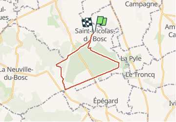

Length
10.2 km

Max alt
152 m

Uphill gradient
104 m
Km-Effort
11.5 km

Min alt
109 m

Downhill gradient
106 m
Boucle
Yes
Creation date :
2019-07-02 07:09:55.233
Updated on :
2019-07-02 07:09:55.233
--
Difficulty : Unknown

FREE GPS app for hiking
 SityTrail
IGN / Geographical institutes
SityTrail Plus
The world is yours!
About
Trail Walking of 10.2 km to be discovered at Normandy, Eure, Le Bosc-du-Theil. This trail is proposed by doudet.
Positioning
Country:
France
Region :
Normandy
Department/Province :
Eure
Municipality :
Le Bosc-du-Theil
Location:
Unknown
Start:(Dec)
Start:(UTM)
344803 ; 5453158 (31U) N.
Comments